Spring is a good time to visit northern Arizona: not too hot yet, plenty of sunshine (even too much for the unwary – use sunscreen!). This was my fourth visit to the Grand Canyon, and it remains an amazing place. It is impossible to adequately photograph the Canyon, especially when one is not a good photographer to start with, so I include just a couple; there are many more on the web, and a well-printed ‘coffee table’ book is even better. Since some of these pics are quite tall, their caption may not be visible at first; keep in mind that the captions follow the photos.
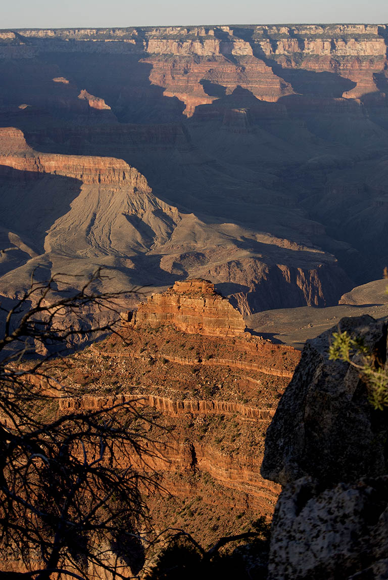
Grand Canyon
A shot made in the evening, as the Sun approaches the horizon.
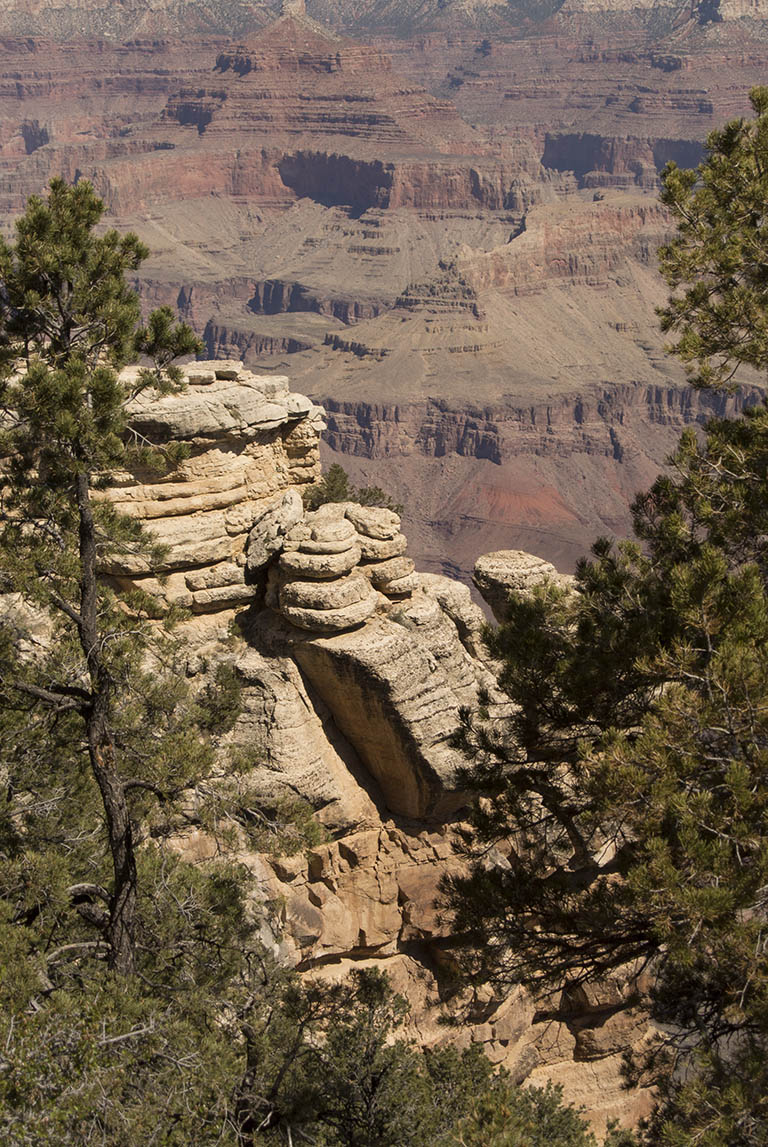
Canyon Grand
The white sandstone in the foreground is near the top of the stratigraphy of the canyon.
The flat lighting of mid-day leads to less dramatic photos.
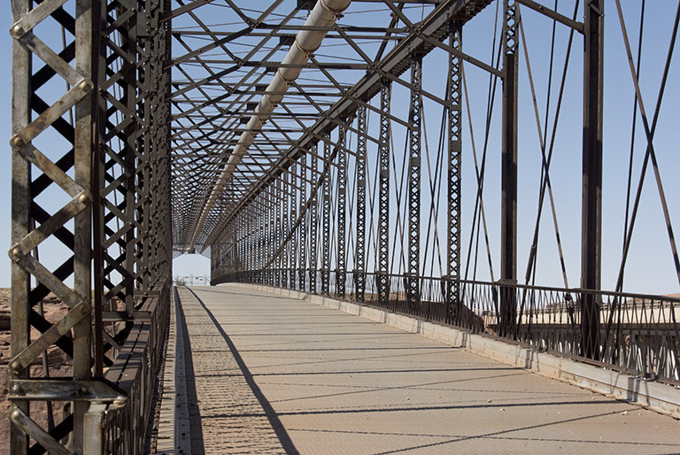
Cameron bridge
Crossing the Little Colorado river just a few yards north of the Cameron trading post, this splendid bridge has been replaced by a boring concrete bridge; these days its purpose appears to be to carry a pipeline across the canyon. Perhaps the main reason to be in Cameron is to enter the Grand Canyon from the East entrance. Stop at the trading post for an excellent lunch, and there are lots of crafts to buy in the store.
Sunset Crater Volcano National Monument is not far from Flagstaff, and Wupatki National Monument is a few miles north of the Crater. Together, they provide an excellent comment on the relationship between geology and people: the eruption of the volcano provided improved soil conditions, making possible the development of a small community in this arid region, 800 years ago.
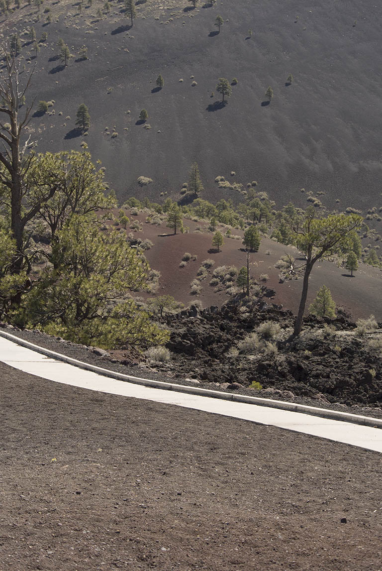
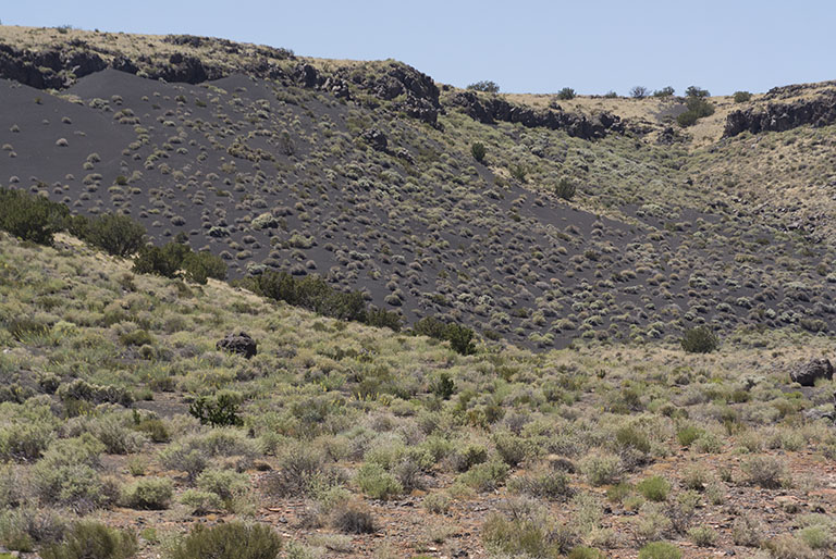
Sunset Crater
Black cinders contrast with the reddish cinders on the flank of the volcano.
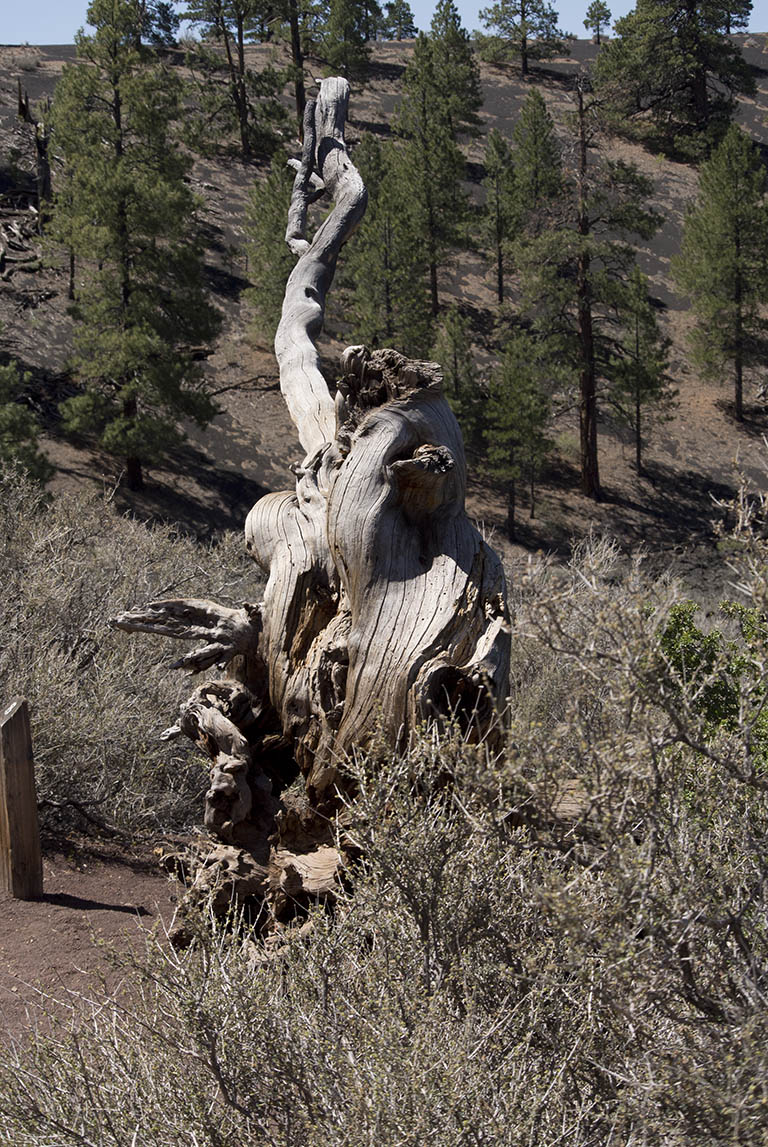
Sunset Crater
A dead tree on the path near the foot of the crater. An ecology such as this is surprisingly easy to impact;
in the 1930s people were allowed to wander all over the mountain, causing considerable destruction;
it is now required that people stay on the paths.
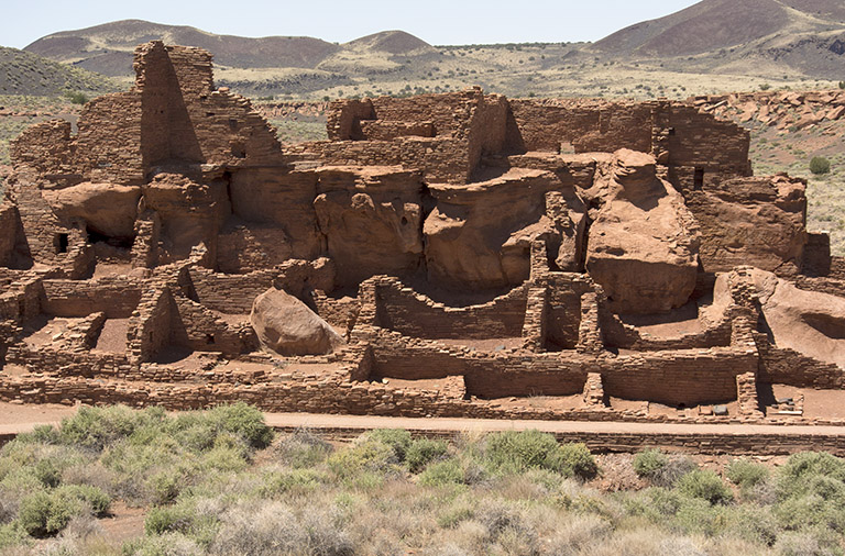
Wuptaki National Monument
An overview of the pueblo; the village population at its height is estimated to have been one hundred.
Wupatki
The pueblo is sited near the head of a small shrub-covered valley. The black soil is weathered from the cap of volcanic rock at the top of the slope.
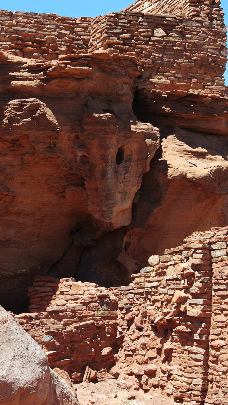
Wupatki
The pueblo is closely integrated with the sandstone bedrock.
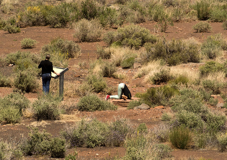
Wupatki blowhole
As we followed the pathways through the village, this startling sight presented itself from 100 yards away. We could not figure out what in the world this woman was doing until we got right up to the blowhole information plaque. The peoples of the region were aware of several blowholes, where caverns under a village would ‘breathe’ through small surface holes in response to changes in atmospheric presure.
A trip to the Petrified Forest National Park (which includes part of the Painted Desert area) is a must if you are in eastern Arizona. It is best to start at the northern, Painted Desert, end (off of Interstate 40) and work your way south to the Petrified Forest, leaving via Highway 180.
Painted Desert
The Painted Desert has some very bright reds. And very little vegetation.
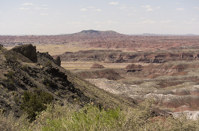
Painted Desert panorama
This gives an idea of the vastness of the Painted Desert region.
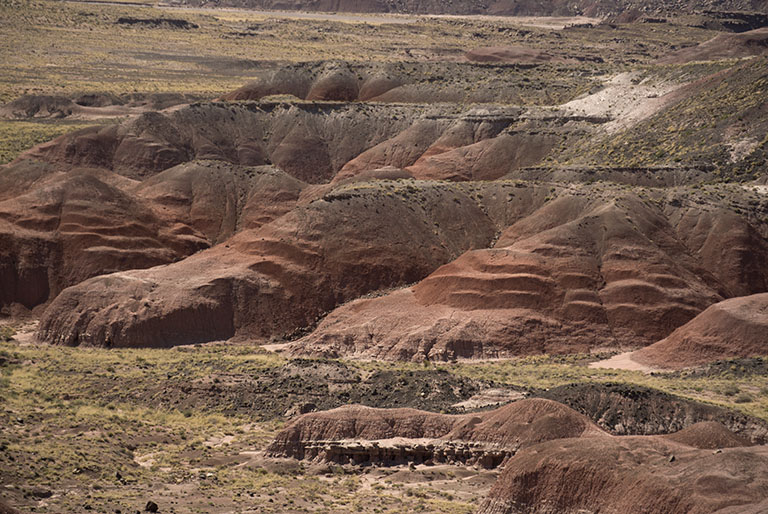
Painted Desert steps
The hillside steps are formed by slight differences in resistance to erosion by the various layers. The scale is difficult to judge—the steps are each 20 to 30 feet tall.
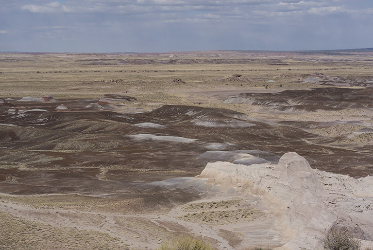
Painted Desert mounds
These dark mounds are near the entrance to the park.
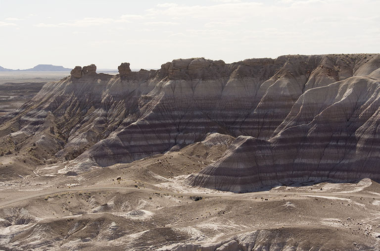
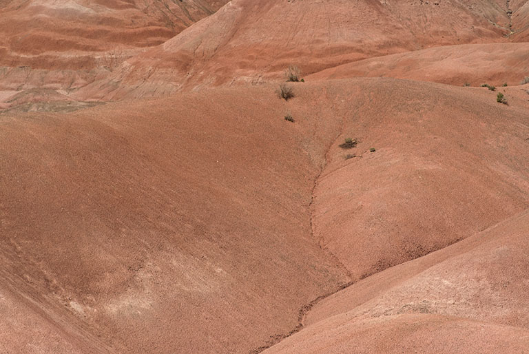
Painted Desert stripes
Slight differences in the chemical composition of the soil layers can lead to significant color changes in the modern eroded landscape. For scale, the brown path at the foot of these cliffs is actually a one-lane road.
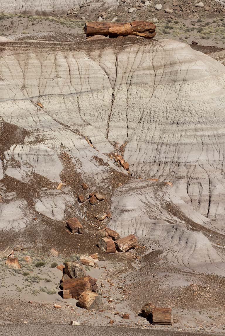
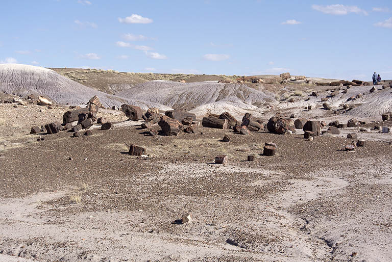
Petrified Forest
A massive log – about 20 feet long – at the top of a cliff, with fallen chunks below.
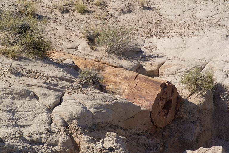
Petrified Forest
A log slowly emerges from the eroding landscape.
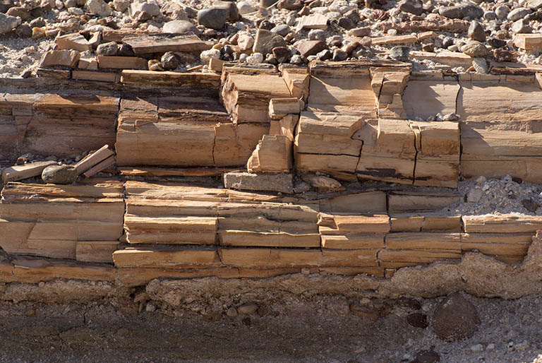
Petrified Forest
It is amazing how much this looks like real wood which is rotting into chunks. Even the colors of the minerals looks like wood.
Petrified Forest trail
About halfway through the Forest is a short looping path which allows the visitor some close-up views of stone trees.
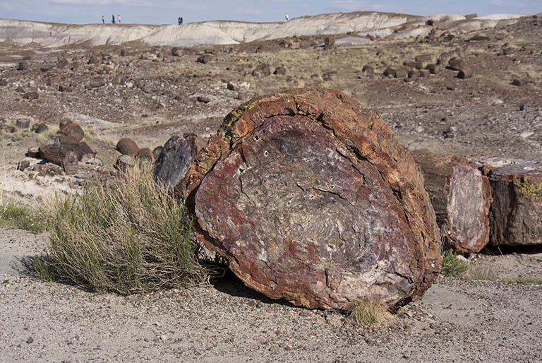
Petrified Forest
This end-on view shows that, for some reason, the bark has mineralised in a different color than the wood, mimicking the structure of the actual tree.
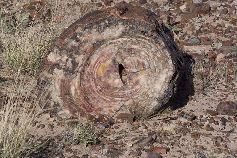
Petrified Forest
Logs sometimes rotted out their heartwood before petrification, forming cavities in the minerals. Then, probably at a later time, crystals of quartz and other minerals formed within the cavity. Unfortunately, almost all of these crystals were stolen by souvenir hunters in the early part of the twentieth century.
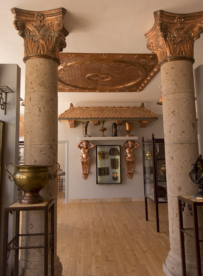
Copper Museum
In the small town of Clarkdale is a small but highly interesting museum about copper. Not mining or refining it, but things that are made of copper.
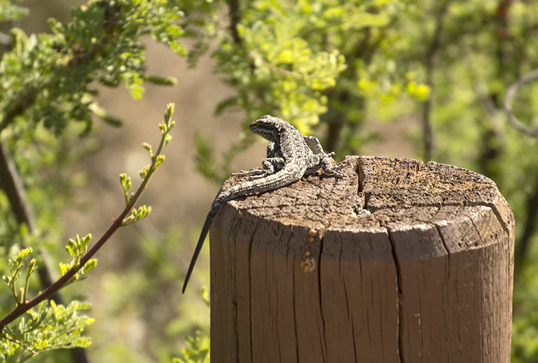
Lizard
Sunning himself on a post, this cautious lizard scampered away as soon as I came within his ‘danger’ boundary.